A former Portlander who now lives on the West Side, Naomi Fast is our Washington County correspondent.
In Beaverton, Millikan Way is a useful route to be acquainted with for visits to — or through — the city on a bike. If you’re new to this area of Washington County, or if you haven’t ventured out on a bike much yet, here are a few things to know.
The geographic and planning context
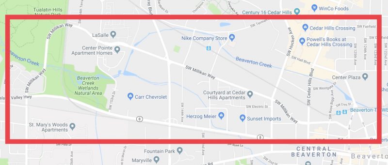
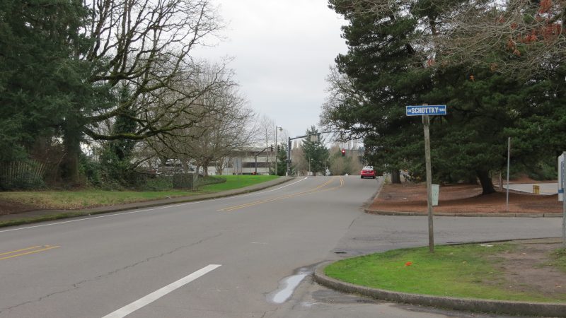
Millikan is mostly thought of as an east-west passage. However, at the western end, where SW 160th Ave becomes Millikan at Tualatin Valley (TV) Hwy, the route first heads north through the Tualatin Valley Nature park, then curves past a trail that leads to Merlo MAX before straightening eastbound to Murray.
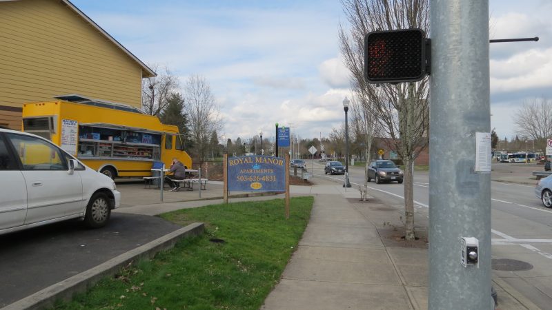
There’s a bike lane gap in this segment, between Murray and the Beaverton Creek bridge closest to TV Hwy. Motor vehicles users have two full lanes in each direction. Going east, after Millikan intersects Murray, the bike lanes resume and drivers have one lane each. The road veers east-southeast between the MAX tracks and Canyon Rd, passing Beaverton’s Round and two Hall Blvd bike shops before going through the Ford Truck Ranch. Millikan ends at SW Lombard Ave, next to Richi’s Taco truck and across the street from the Beaverton Transit Center.
Millikan is part of a Beaverton capital project known as the Canyon Road Alternate Bike Network. Technically, this project only goes as far west as Hocken. Of course, we may be on our way further west than that, or arrive to the bikeway from the west, via north-south arterials like Murray. This spotlight takes that into consideration.
The Good—no, the GREAT!
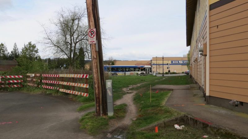
For a long time, Millikan’s pavement didn’t quite reach Lombard. But Millikan received a big dose of active transportation love from the city last year. This improvement is less than a year old, so anyone who’s still accustomed to avoiding this formerly muddy spot is in for a welcome treat. Check it out: there’s even a wayfinding sign!
The Bad
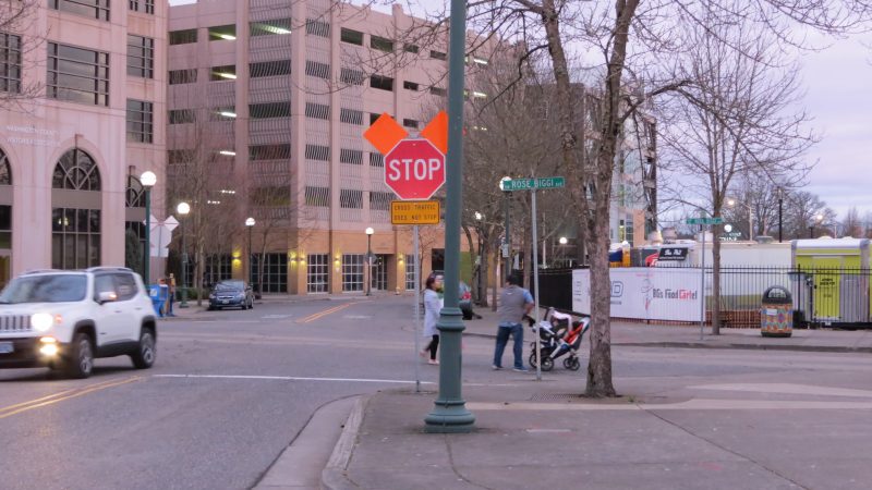
At City Hall, where the new BG’s Food Cartel is, Millikan intersects with Rose Biggi. Millikan narrows even more, and bike lanes are swapped for sharrows. To me, sharrows here aren’t the “bad” thing—not after riding the western segment that’s four lanes across, none of which are bike lanes. Notice the stop signs, though, alerting to the fact that this is a two-way stop. People riding on the bicycle route must stop, while people crossing the bikeway in cars do not stop.
I might not have instantly found this counterintuitive if I hadn’t ridden Portland’s neighborhood greenways, like NE Going St. That bikeway also has two-way stops. But on Going, I remember those stops being for people crossing the bikeway. It not only makes riding easier, but safer.
It doesn’t make sense for the best-known bike network in Beaverton to have an intersection where drivers are not required to stop before crossing the bikeway. I brought that up at a Bicycle Advisory Committee meeting. The hearsay is, various train tracks are the reason for this unfortunate tricky spot. But the food carts are receiving lots of visitors now, with many coming on foot. Maybe the solution is to close northbound Rose Biggi to cars at Millikan, such that Rose Biggi is open only to people using active modes between the MAX tracks and Millikan? I’m not a traffic safety engineer, so I really don’t know. I can, however, report how it feels to cross a street on my bicycle where motored cross-traffic doesn’t stop: bad.
The Bumpy
I love big trees like the ones along Millikan. My preference as a bike-commuter is that they be cared for, not cut down, not even for roads. It takes years for trees to grow large, and biking on streets shaded by rows of healthy trees is one of summer’s most pleasant travel options. Trees also make good snack or lunch meeting places, as well as landmarks, like this historic grove of oak trees preserved in Washington County. In fact, the neighborhood Millikan enters west of Murray, Five Oaks, is name for that grove.
So—instead of cutting down established trees living next to roads, I love when engineers seek alternate ways to tackle and work with roots that might bulge into the bike lane. But tackle the problem they should.
I recall one dark, rainy, winter rush hour when I turned to head east on Millikan from southbound Murray. After that ride, Millikan became stuck in my mind as a “bad” place to bike, associated with unexpected bumps, mud, debris and flooding, and darkness contrasted with hundreds of glaring car headlights. I didn’t want to end up always avoiding that stretch, so I went back for a closer look in daylight to see more of the logic behind my negative feelings.
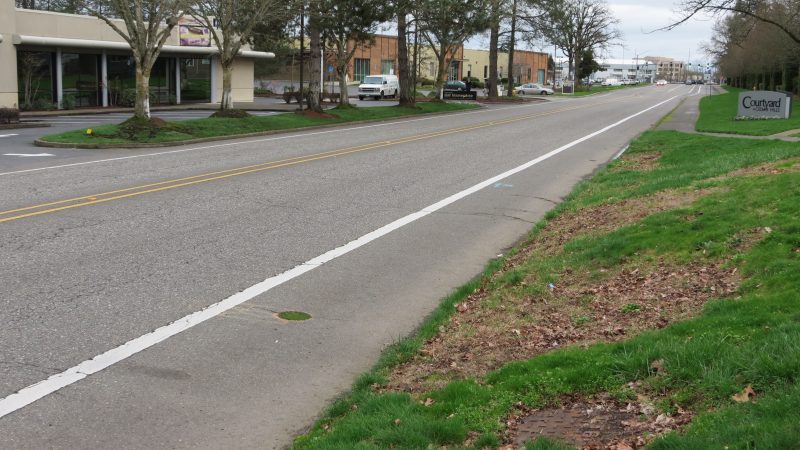
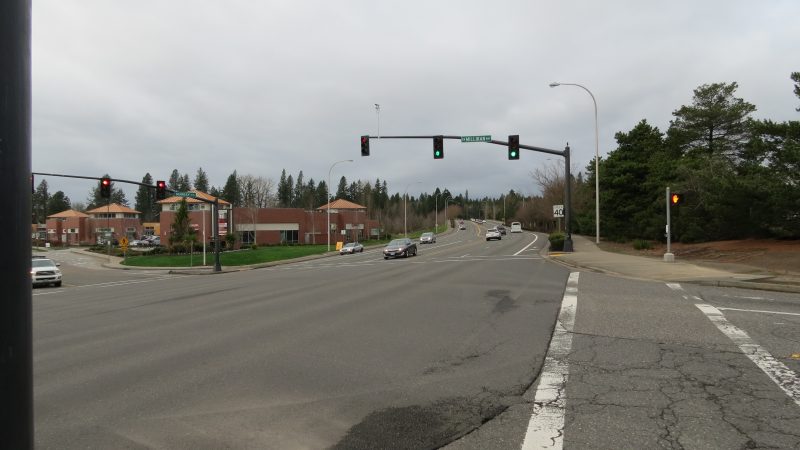
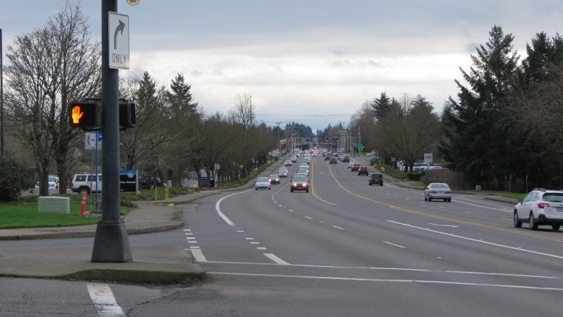
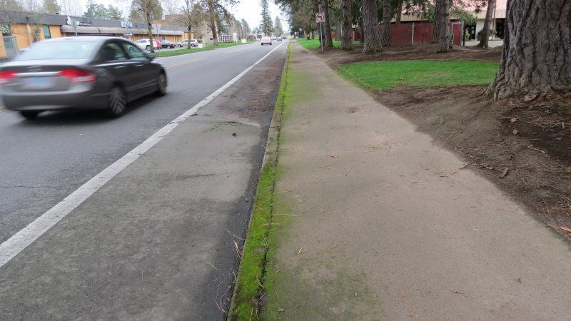
Here’s what I found on Millikan between Murray and Hocken: at least two significant root bulges, resulting in mud and debris pooling in the eastbound bike lane. A utility cut-out, growing grass in a perfect circle. Drivers racing the speed limit. The stretch is sandwiched between two very large intersections, where turning left can be a stressful or cumbersome event.
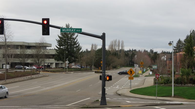
Westbound, the bike lane disappears just before the enormous intersection with Murray. Finally, there’s a sidewalk on only one side of the street, despite the every-30-minutes 62 bus line on this stretch. Sometimes it’s necessary to state the obvious: the solution to people being forced to walk in the bike lane to is to give them a sidewalk — not reduce or remove a much relied-upon bus line.
In Beaverton, the Traffic Commission is the committee that tends to handle these sorts of street concerns; they can be contacted via email jkhasho@beavertonoregon.gov. With the addition of more walk-to and bike-to destinations along Millikan, it makes sense for the city to prioritize making Millikan a bike route to feel good riding on year round, and as far west as possible.
Go West, young bikeway!
— Naomi Fast, @_the_clearing on Twitter
Read more of her dispatches here.
Never miss a story. Get this and other posts delivered to your inbox.
BikePortland needs your support.
The post A closer look at cycling on Millikan Way in Beaverton appeared first on BikePortland.org.
from BikePortland.org http://ift.tt/2HP8sxl



No comments:
Post a Comment